About Us
Narok South Constituency
The Constituencies Development Fund was created by the Constituencies Development Fund Act, 2003 with the primary objective of addressing poverty at grassroots level by dedicating a minimum of 2.5% of the Government ordinary revenue to grassroots development and the reduction of poverty. The fund is managed by the Constituencies Development Fund Board (NGCDFB)
In January 2013, the NGCDF Act 2003 (as amended in 2007) was repealed and replaced with NGCDF Act 2013 that is aligned to the constitution of Kenya 2010. Since inception, NGCDF has experienced only one transitional period, in run to the 2007 general election. This is the second transition we are transacting after the dispensation of the new constitution 2010 and 4th March, 2013 hotly contested elections.
The enactment of the NGCDF Act 2013 was mainly aimed to ensure that the law governing NGCDF is aligned to the Constitution of Kenya 2010, specifically in compliance with the principles of:
1. Transparency and accountability,
2. Sseparation of powers; and
3. Participation of the people.
4. The new law was also aimed to align the operations of the Fund to the new devolved government structure.
Narok South
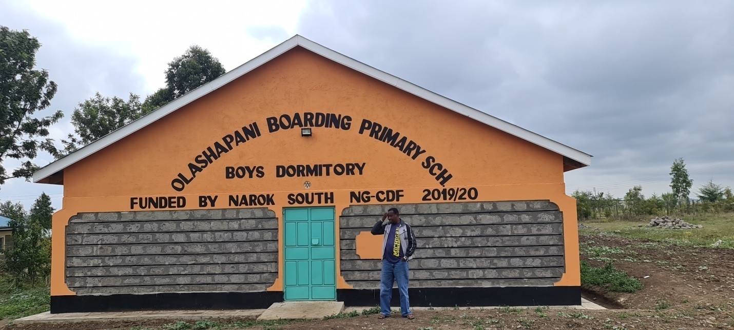
Narok South Constituency is one of the 6 constituencies in Narok County. It covers geographical area of Sq. Km (Approx.) 4,959.20. Currently it has a population of 212,836. It is mainly inhabited by the Maasai and the Kalenjin communities. Farming is the main economic activity in the constituency.
Access NG-CDF Information on your Mobile


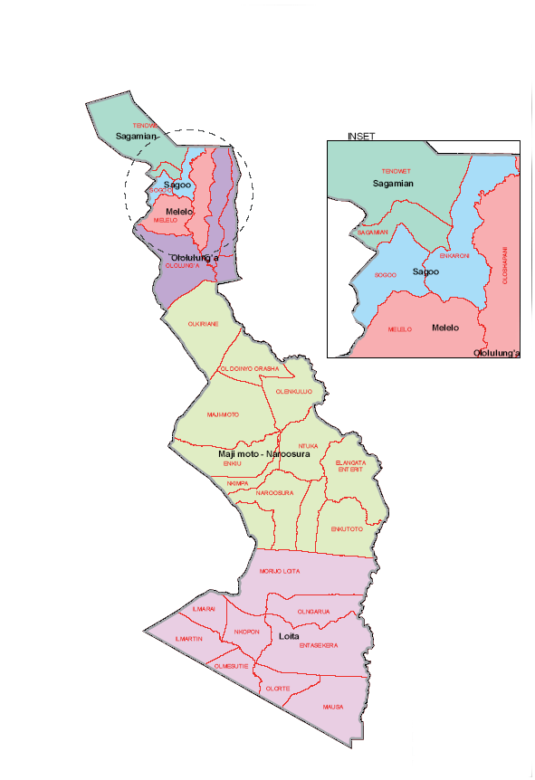
County Assembly Wards in Narok South Constituency :
Sogoo Ward
- County Assembly Ward No.:
- County Assembly Ward Name: Sogoo
- County Assembly Ward Population (Approx.):
- County Assembly Ward Area In Sq. Km (Approx.):
- County Assembly Ward Description: comprises part of
Sagamian Ward
- County Assembly Ward No.:
- County Assembly Ward Name: Sagamian
- County Assembly Ward Population (Approx.):
- County Assembly Ward Area In Sq. Km (Approx.):
- County Assembly Ward Description: comprises part of
Ololulunga Ward
- County Assembly Ward No.:
- County Assembly Ward Name: Ololulunga
- County Assembly Ward Population (Approx.):
- County Assembly Ward Area In Sq. Km (Approx.):
- County Assembly Ward Description: comprises part of
Melelo Ward
- County Assembly Ward No.:
- County Assembly Ward Name: Melelo
- County Assembly Ward Population (Approx.):
- County Assembly Ward Area In Sq. Km (Approx.):
- County Assembly Ward Description: comprises part of
Majimoto/Naroosura Ward
- County Assembly Ward No.:
- County Assembly Ward Name: Majimoto/Naroosura
- County Assembly Ward Population (Approx.):
- County Assembly Ward Area In Sq. Km (Approx.):
- County Assembly Ward Description: comprises part of
Loita Ward
- County Assembly Ward No.:
- County Assembly Ward Name: Loita
- County Assembly Ward Population (Approx.):
- County Assembly Ward Area In Sq. Km (Approx.):
- County Assembly Ward Description: comprises part of